| Home | Parks | Maps | Bios | Stories | Links |
|---|
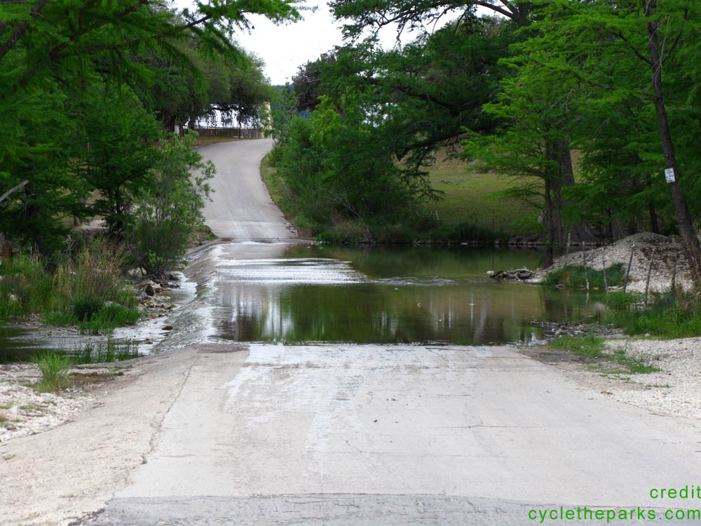
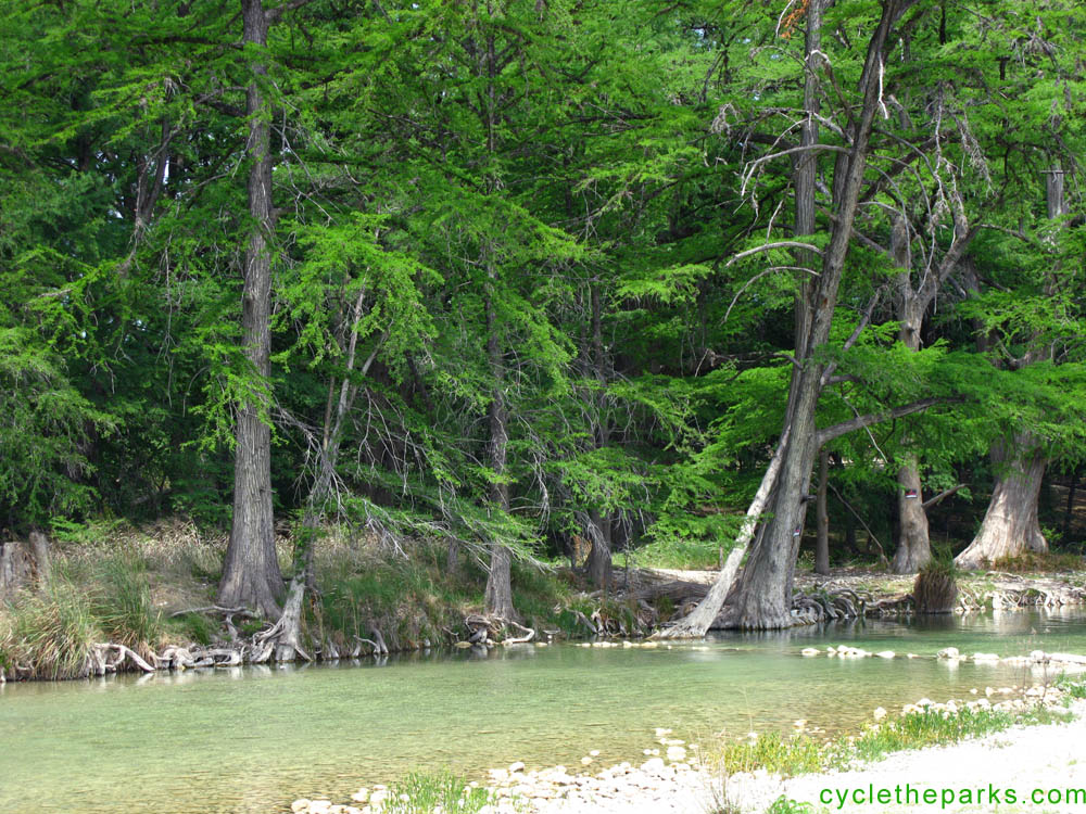
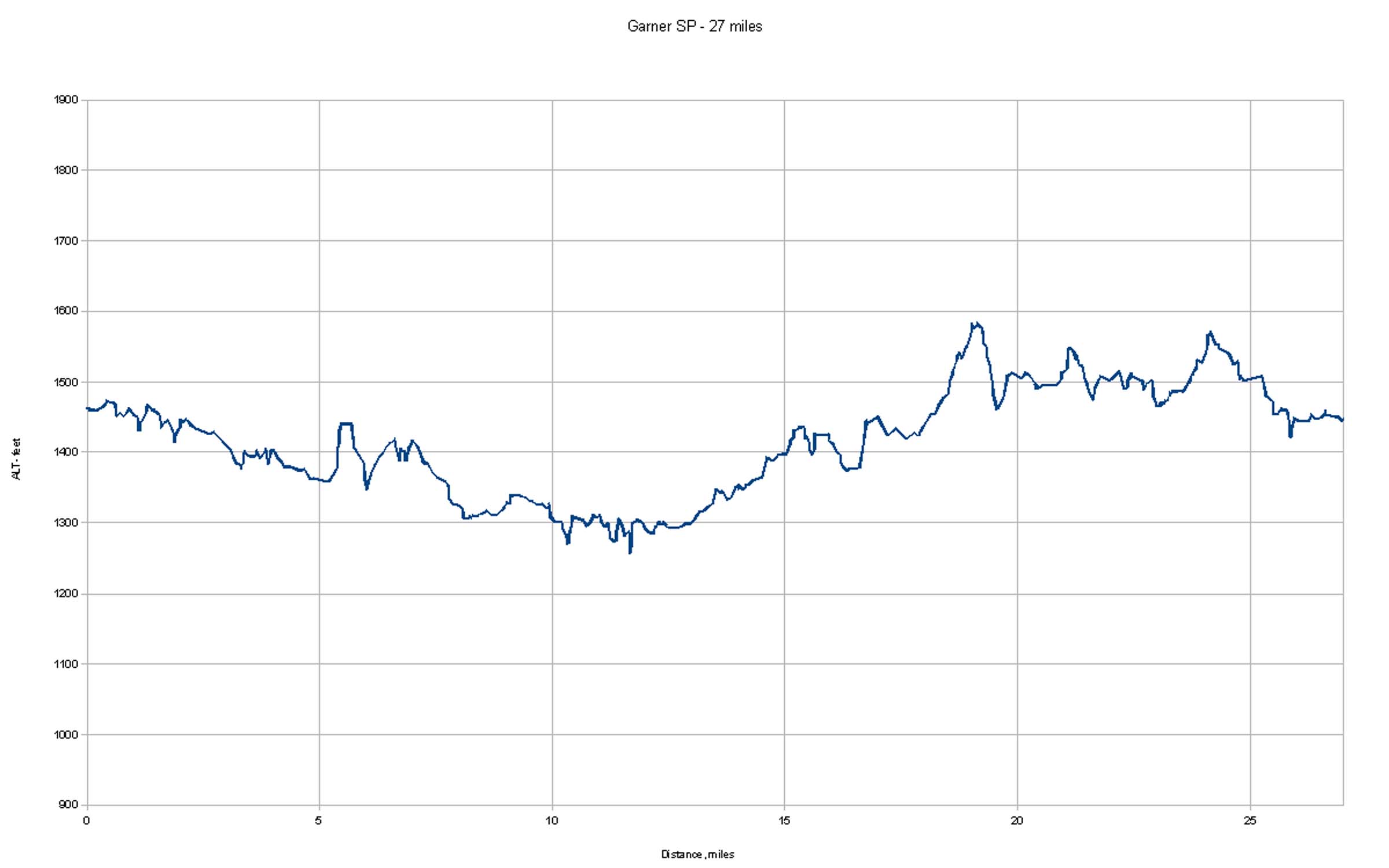
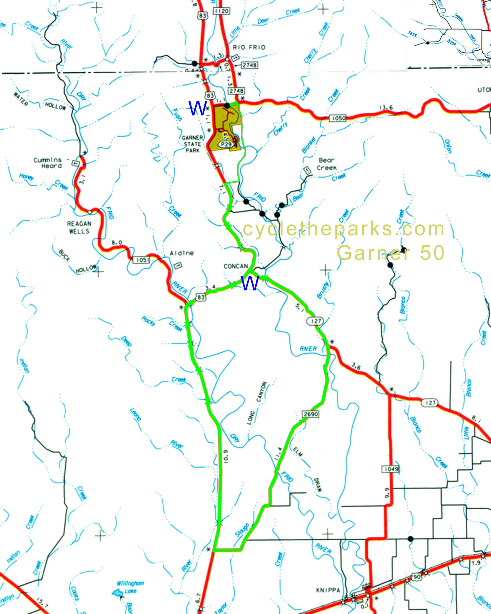
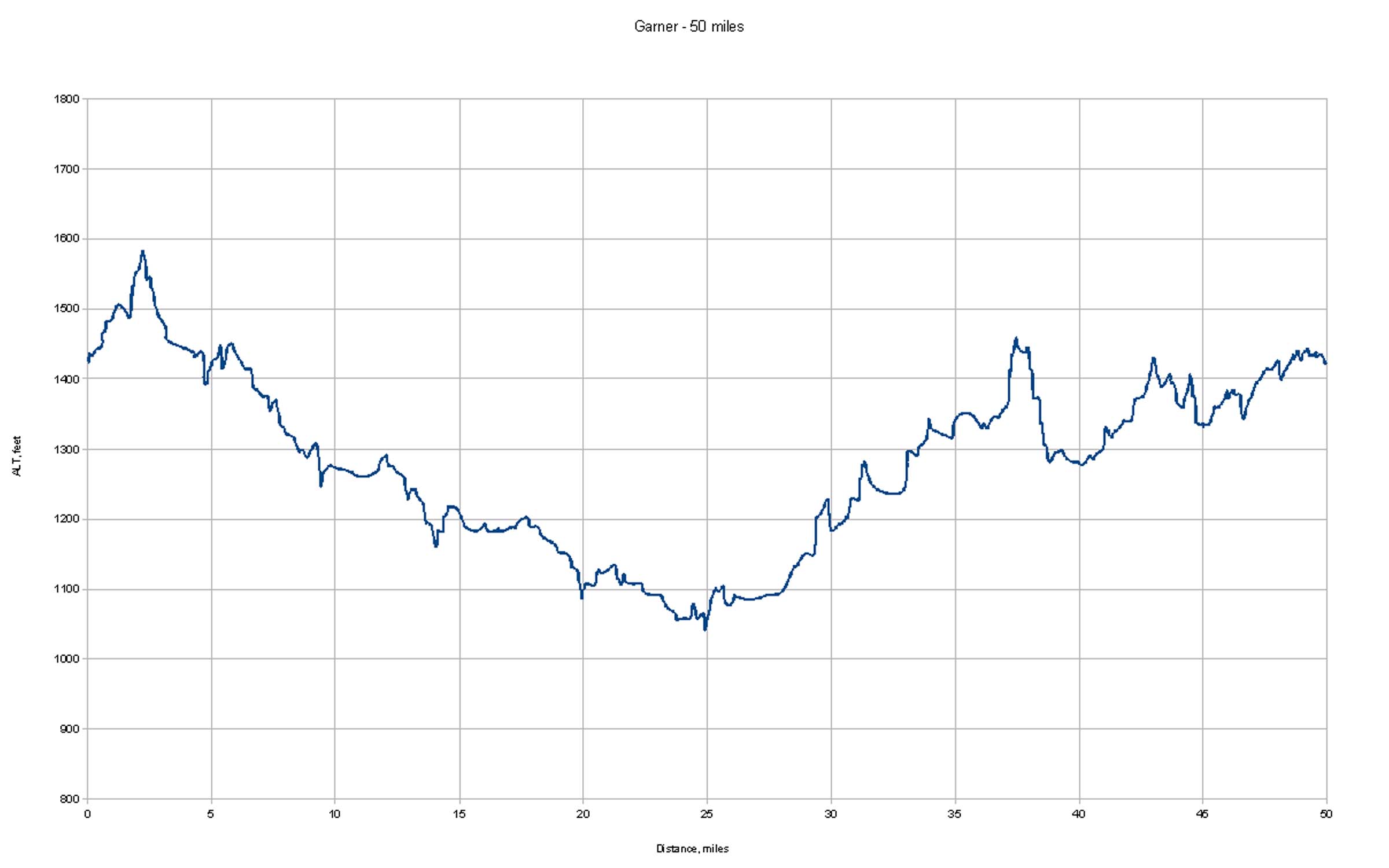
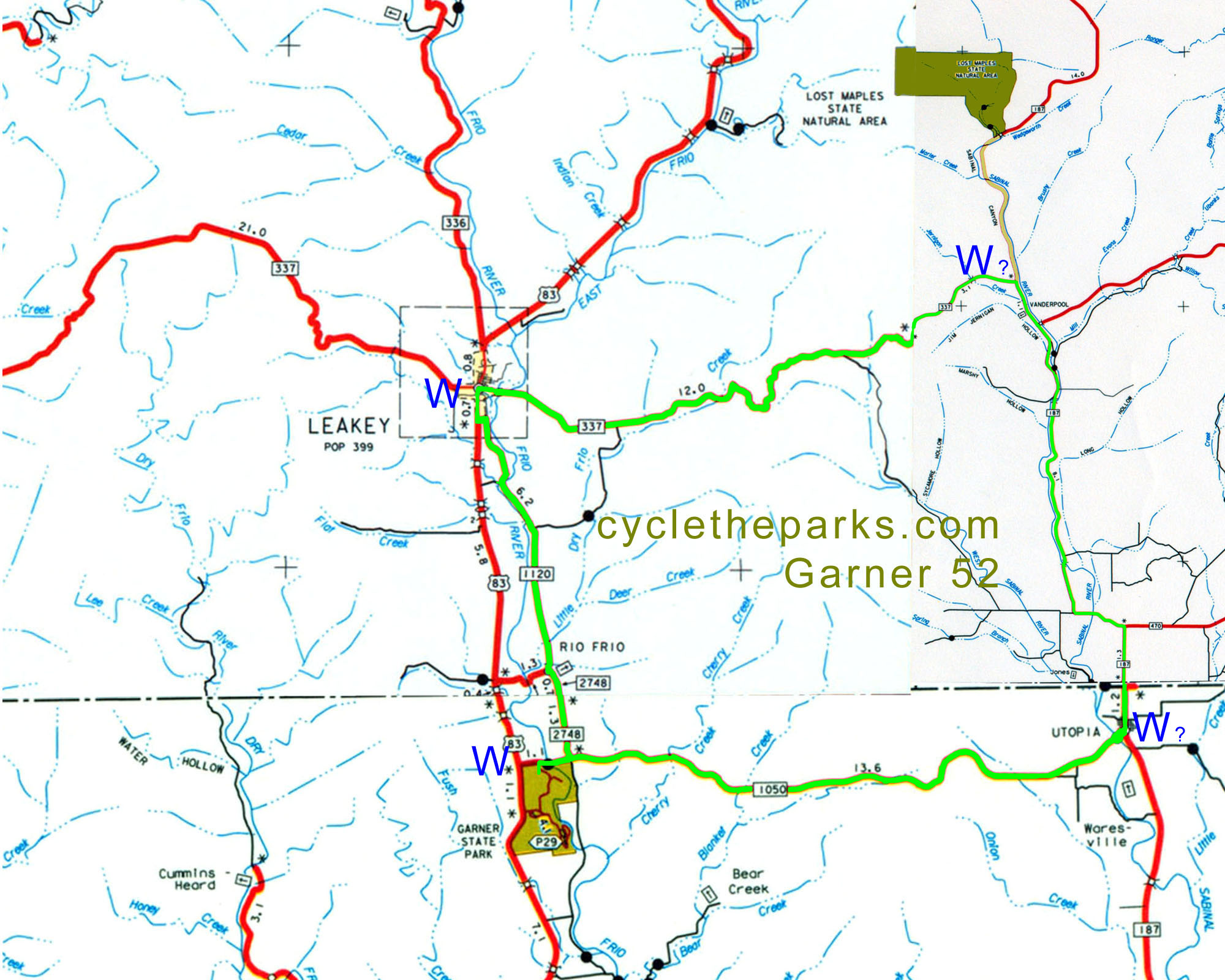
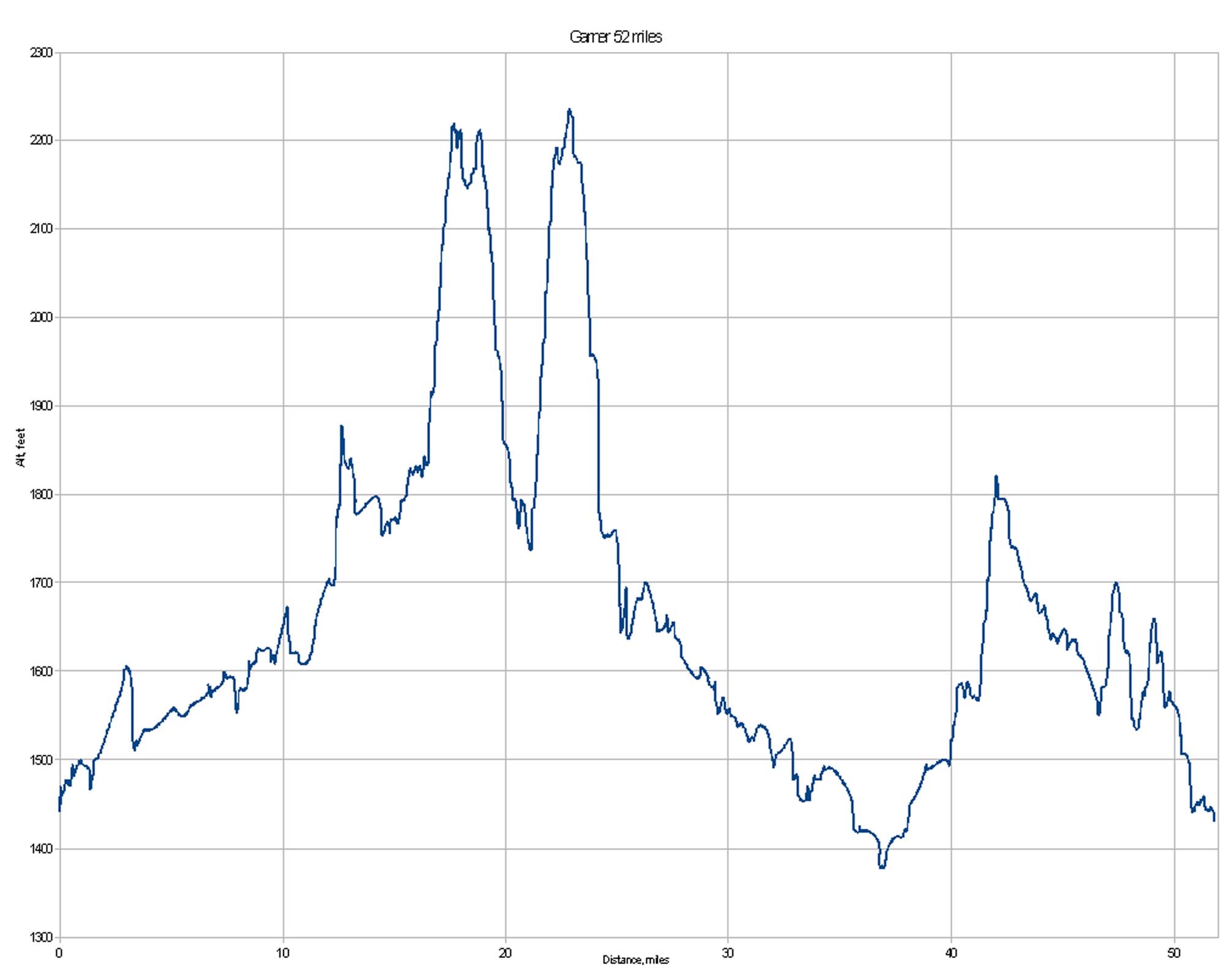
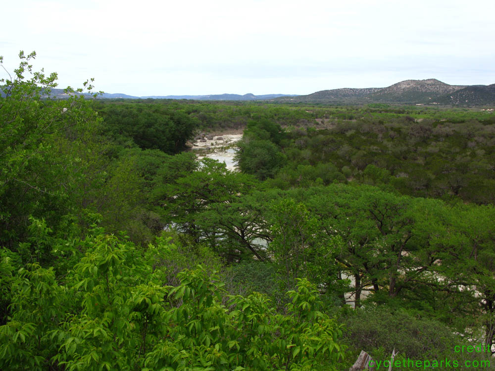
Garner SP is very close to nothing (or between Leakey and Uvalde). It is on the beautiful Frio river and one of the routes goes through it. The Park gets incrediably busy in the summer, but alternate camping can be found along CR350 to the west of the park. Call ahead !! Garner is south of Lost Maples SNA. Water is very limited, get it every chance you can. There are a few low water crossings of the Frio, do NOT try and ride them. Walking in bare feet is comfortable, and very slippery. The 27 and 50 mile routes are about as flat as a hill country ride can be. The 52 mile route is hard.
| Name | Phone number | City |
|---|---|---|
| Garner SP | 830 232 6132 | Concan |
| Bandera county sheriff | 830 796 3771 | Bandera |
| Kerr county sheriff | 830 257 7904 | Kerrville |
| Real county sheriff | 830 232 5201 | Leakey |
| Uvalde county sheriff | 830 278 4101 | Uvalde |
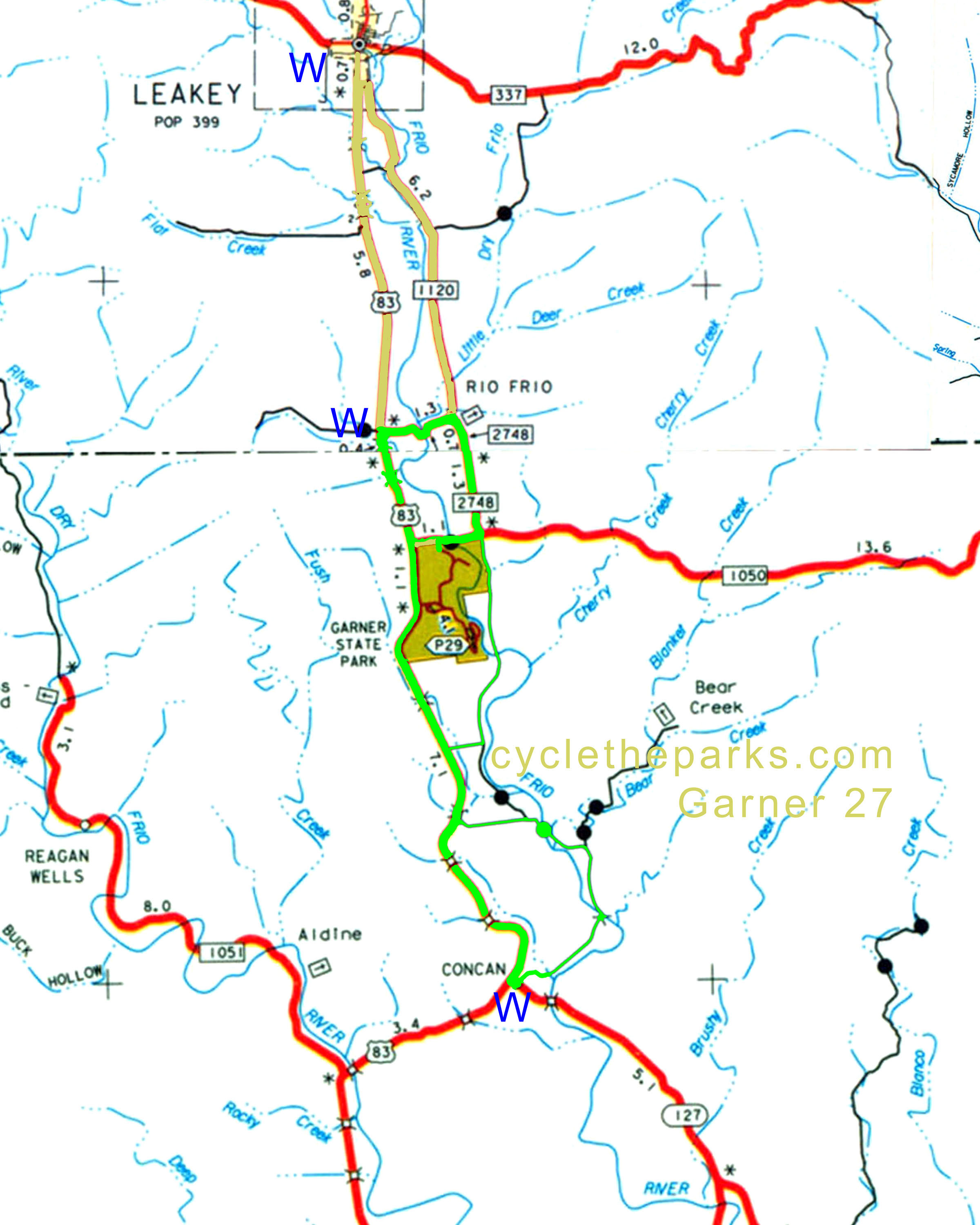
The 27 mile que sheet includes options for 21, 27, and 38 miles.
| distance | Climbing | que Sheet | map | Garmin route | Google earth | Profile |
|---|---|---|---|---|---|---|
| 27 (21, 38 options) miles | 1528 feet | q-27 |
| route-27 | earth-27 |
|
| 50 miles | 1656 feet | q-50 |
| route-50 | earth-50 |
|
| 52 miles | 3045 feet | q-52 |
| route-52 | earth-52 |
|
For Google earth, right click and select "save as" or "save link as", remember your saved location. Then open Google Earth, , select File - open, navigate/select the newly saved file.
For Garmin routes, right click and select "save as" or "save link as", remember your saved location. Follow your Garmin's instructions on saving and using routes.
routes inspected May 2011