


| Home | Parks | Maps | Bios | Stories | Links |
|---|
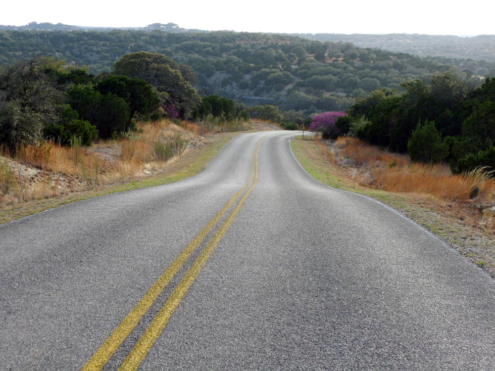
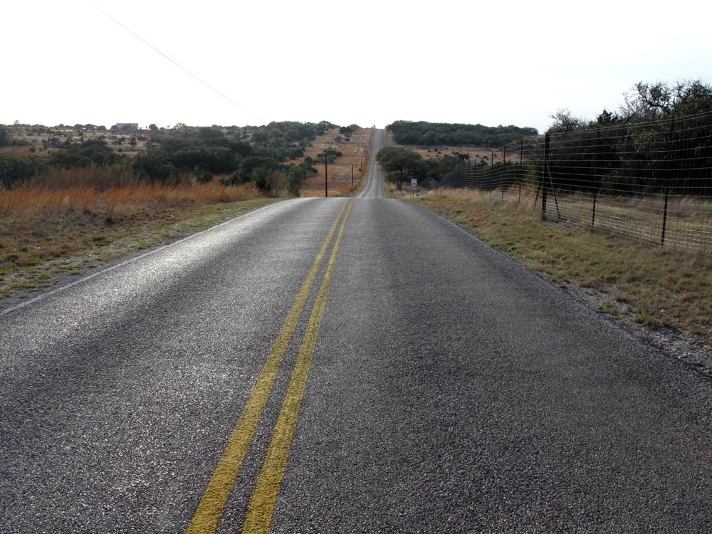
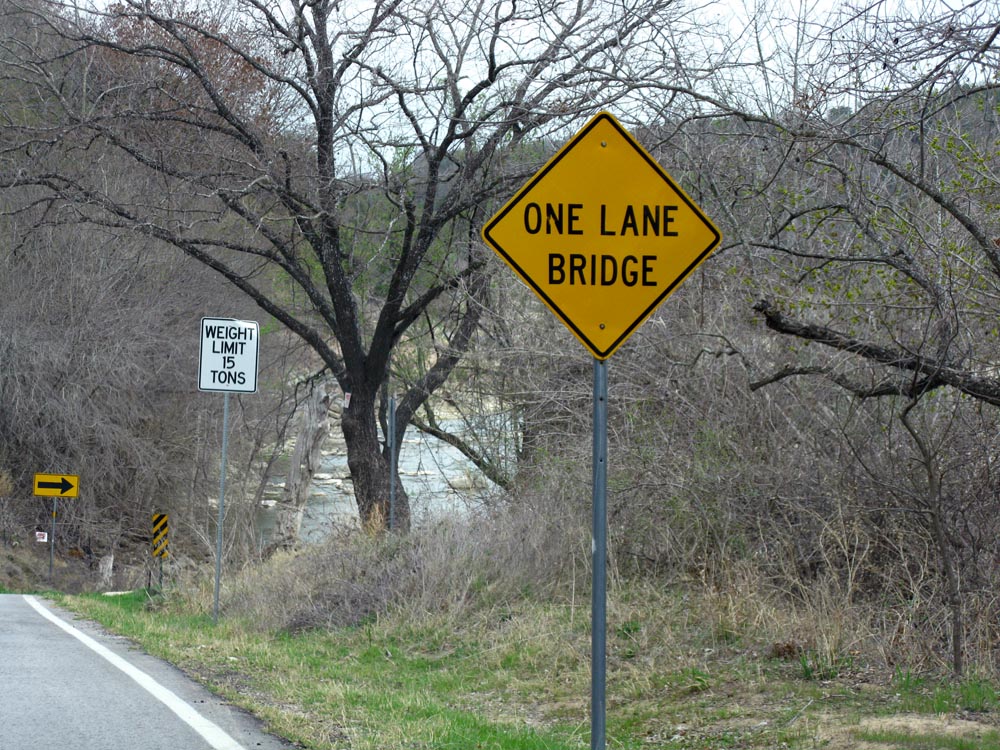
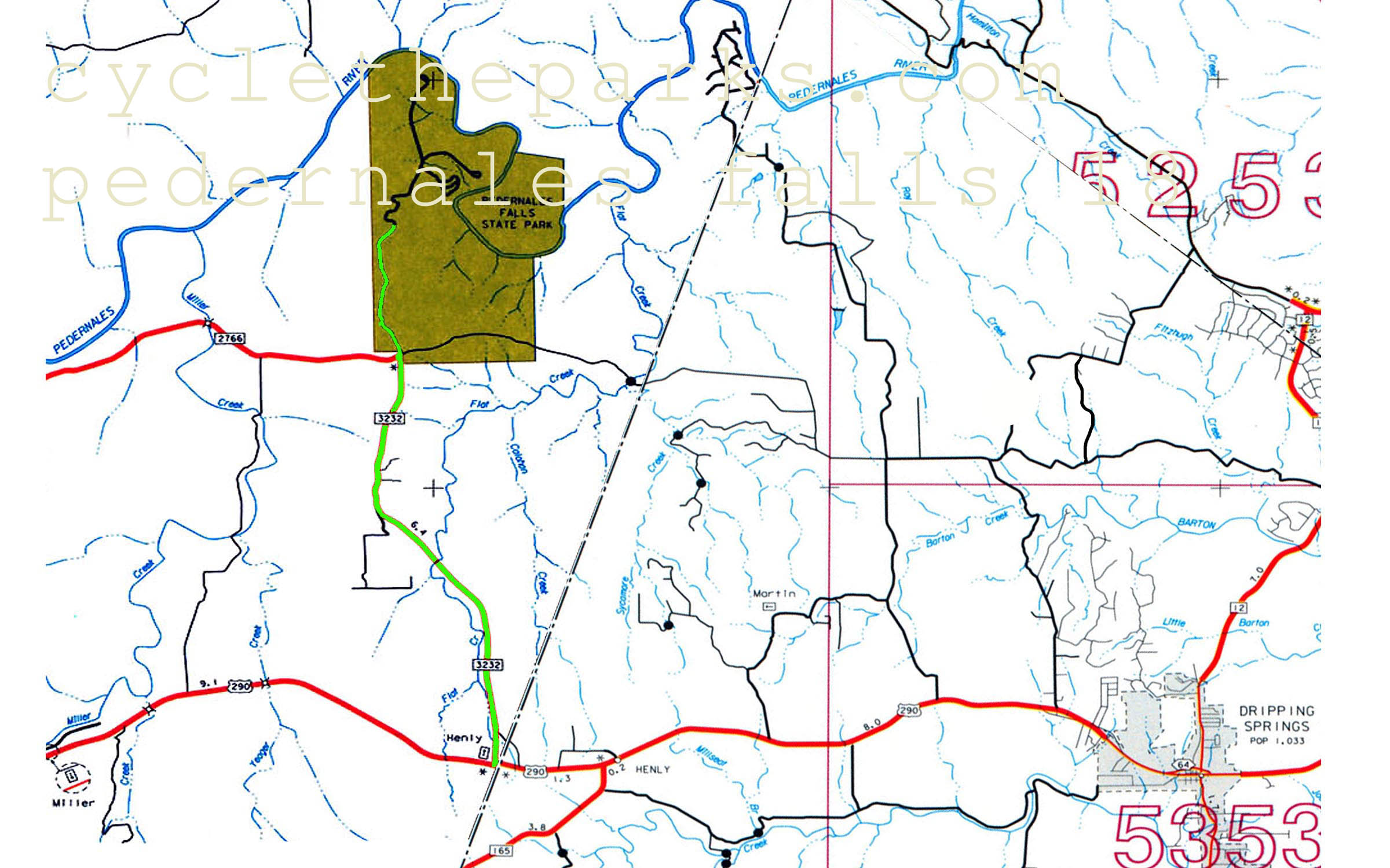
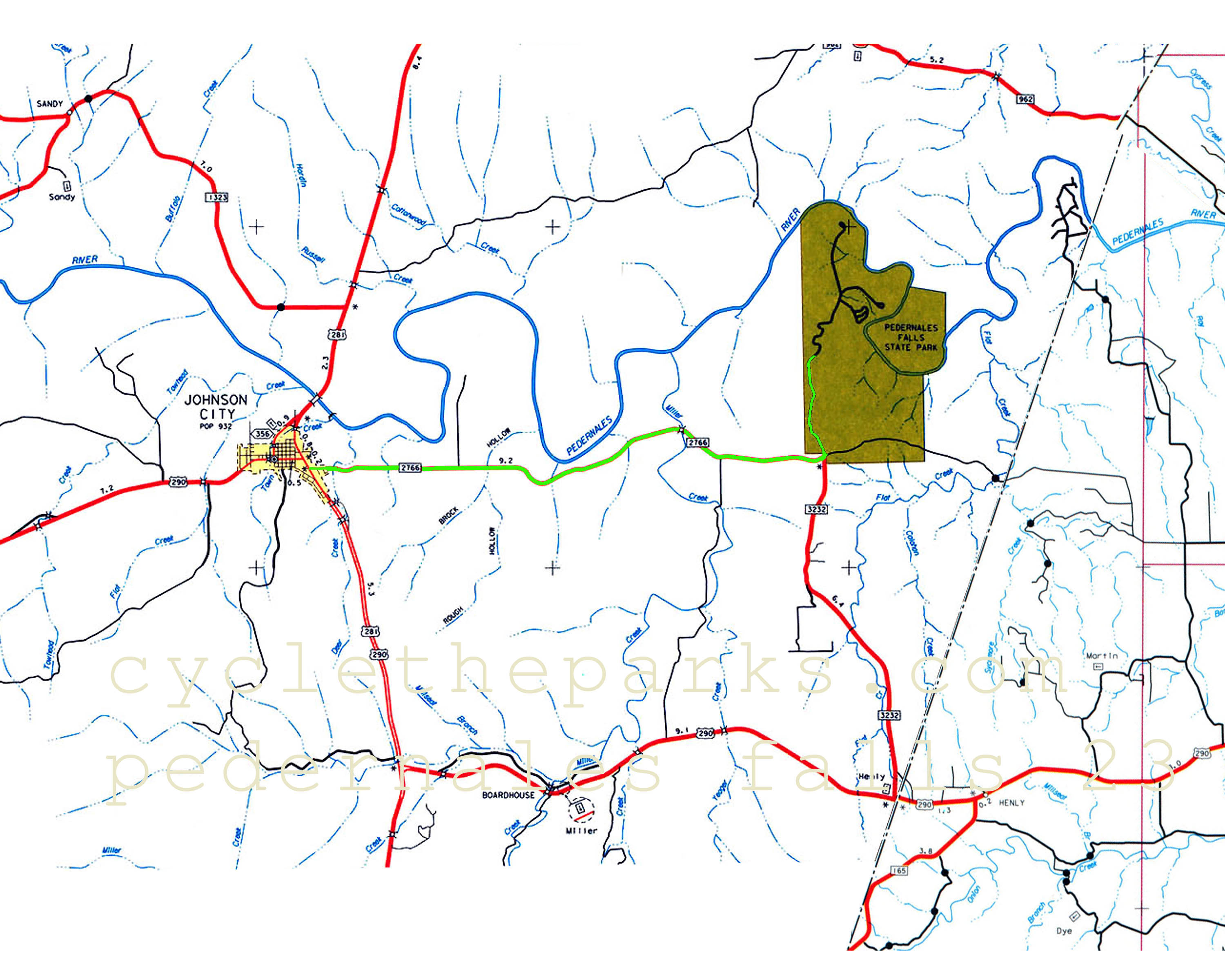
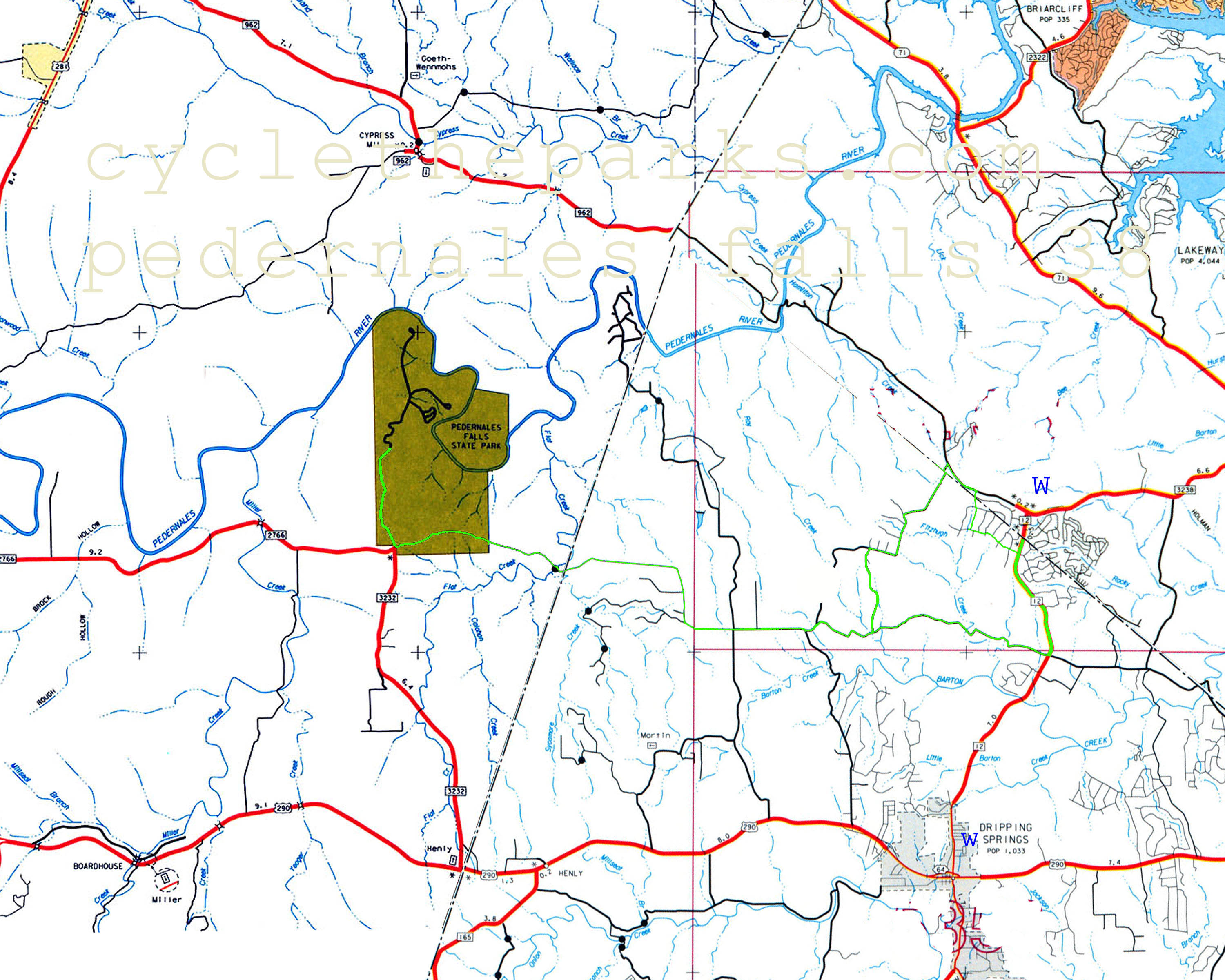
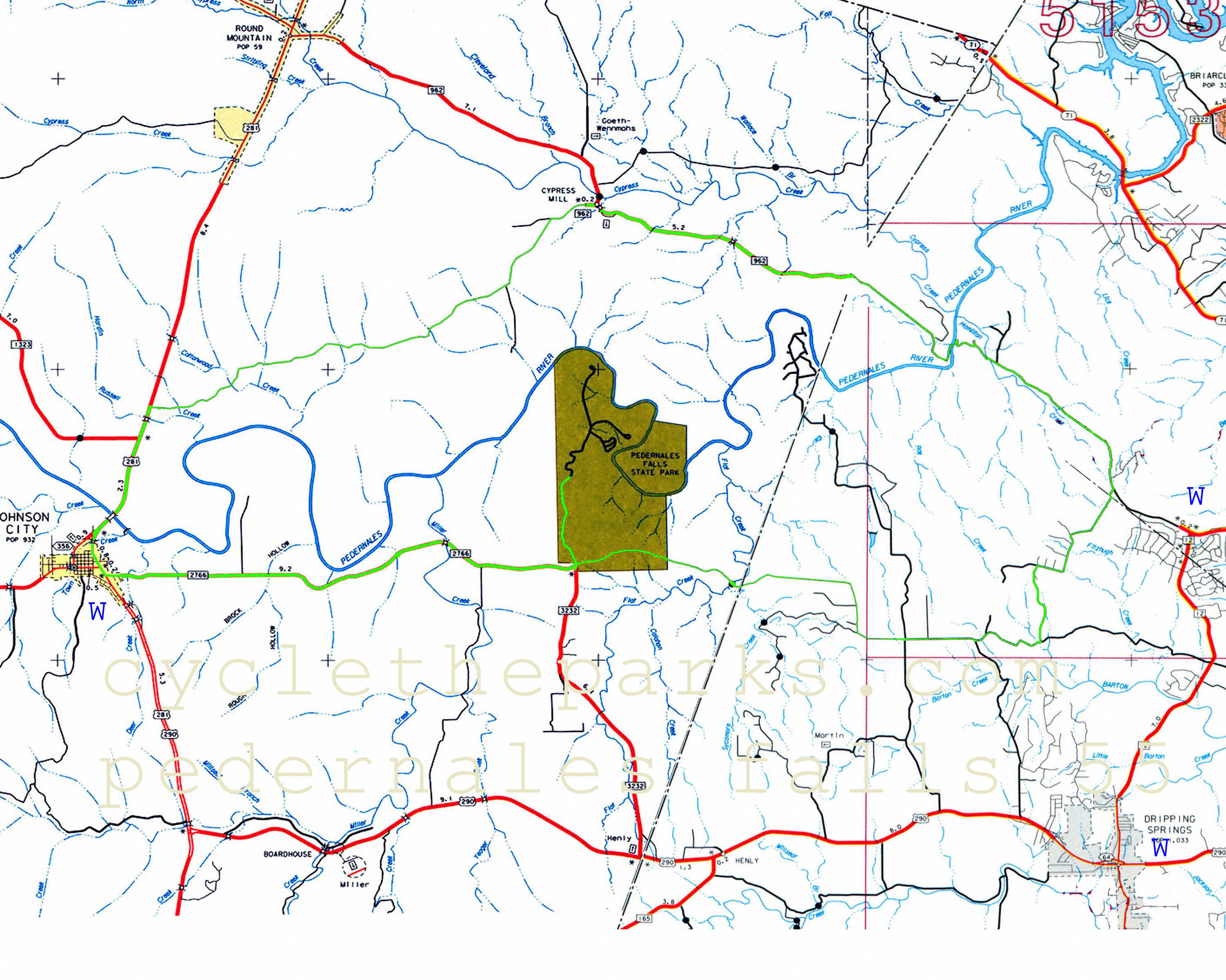
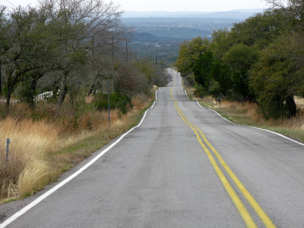
Pedernales Falls SP is a typical example of the the Edwards Plateau terrain. It is located between Dripping Spings and Johnson City. There is good hiking and swimming. Smaller roads often have cattle guards (open range), so you have to dodge more then livestock. The numerous county roads in the area are good, but are frequently chip sealed, resulting in a rough ride. Limited traffic, and extremely hilly terrian make for fun and wickedely challenging rides. Be prepared with lots of water, and stop when you can for refills. The park is bounded to the south and west by 290, 12 to the west and the Pedernales river to the north, this makes the choice of roads limited. I hate out and back routes, but the roads are begging to be ridden.
| Name | Phone number | City |
|---|---|---|
| Pedernales Falls SP | 830 868 7304 | Johnson City |
| Blanco County Sheriff | 830 868 7104 | Johnson City |
| Hays County Sheriff | 512 393 7808 | San Marcos |
| Travis County Sheriff | 512 854 9770 | Austin |
| distance | Climbing | que Sheet | map | Garmin route | Google earth | Profile |
|---|---|---|---|---|---|---|
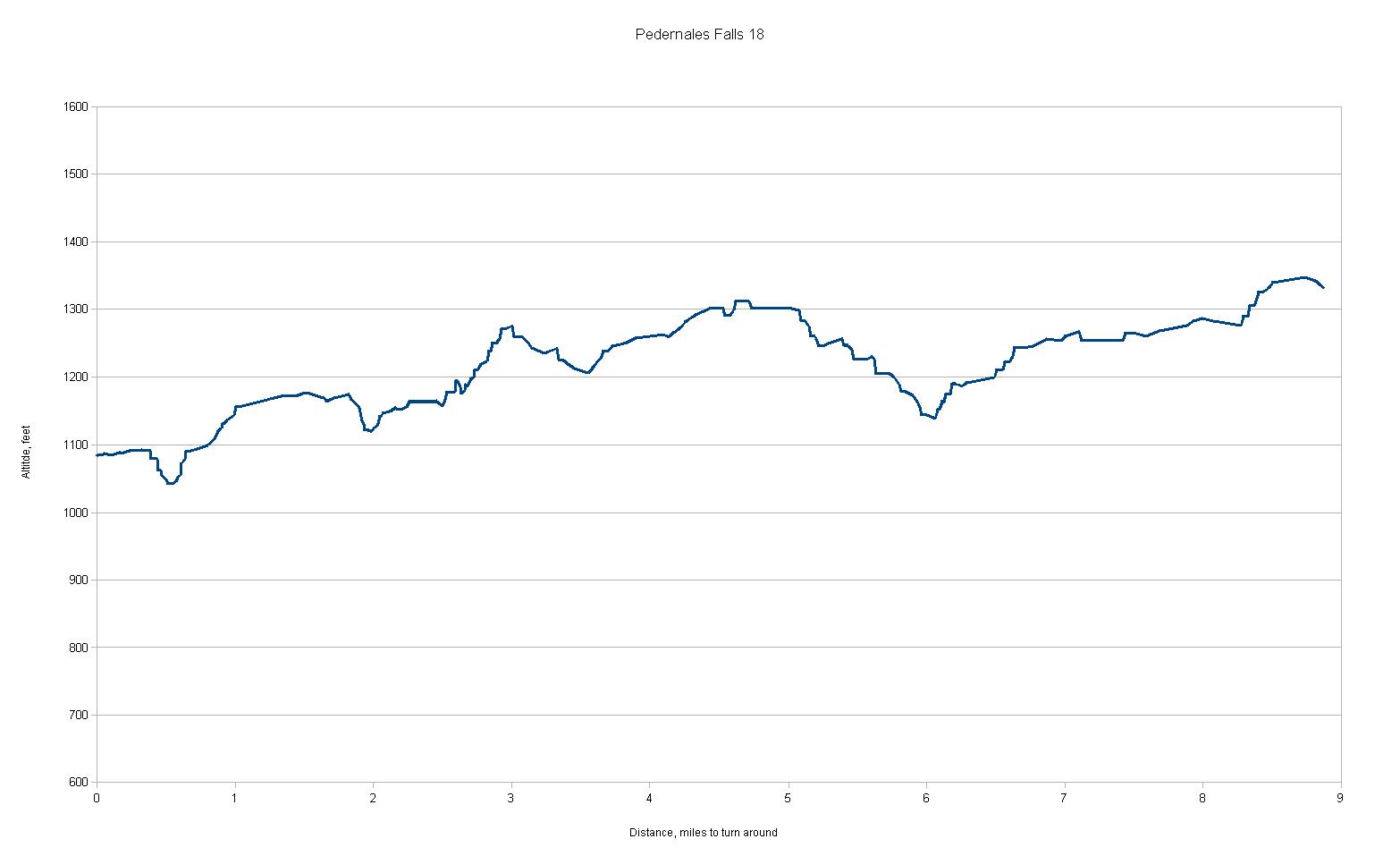
| 18 miles | 1468 feet | q-18 |
| route-18 | earth-18 |
|
| 23 miles | 1912 feet | q-23 |
| route-23 | earth-23 |
|
| 38 miles | 2403 feet | q-38 |
| route-38 | earth-38 |
|
| 55 miles | 3185 feet | q-55 |
| route-55 | earth-55 |
|
For Google earth, right click and select "save as" or "save link as", remember your saved location. Then open Google Earth, , select File - open, navigate/select the newly saved file.
For Garmin routes, right click and select "save as" or "save link as", remember your saved location. Follow your Garmin's instructions on saving and using routes.
March 2011