
| Home | Parks | Maps | Bios | Stories | Links |
|---|
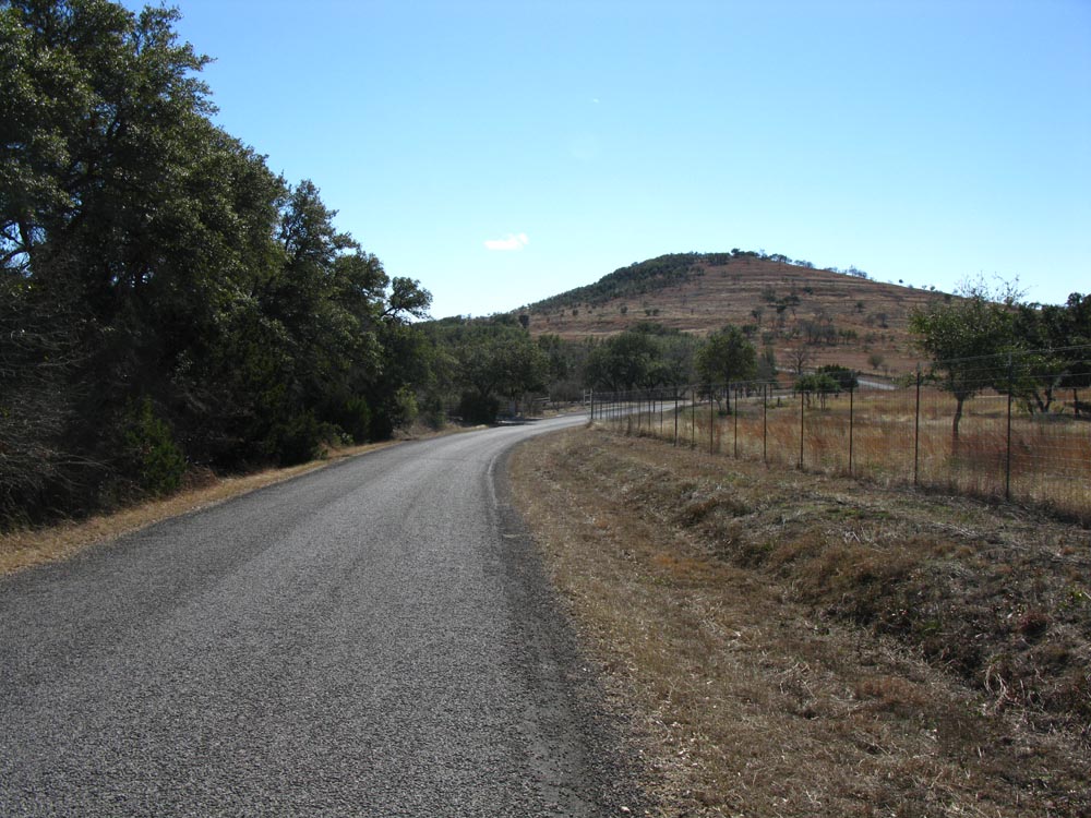
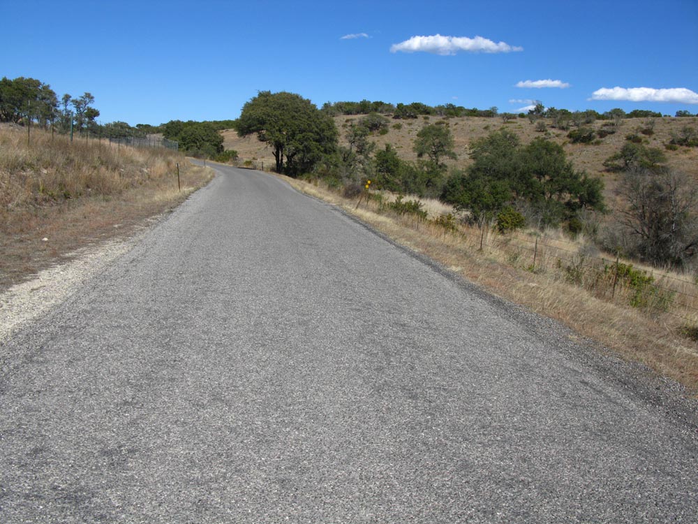
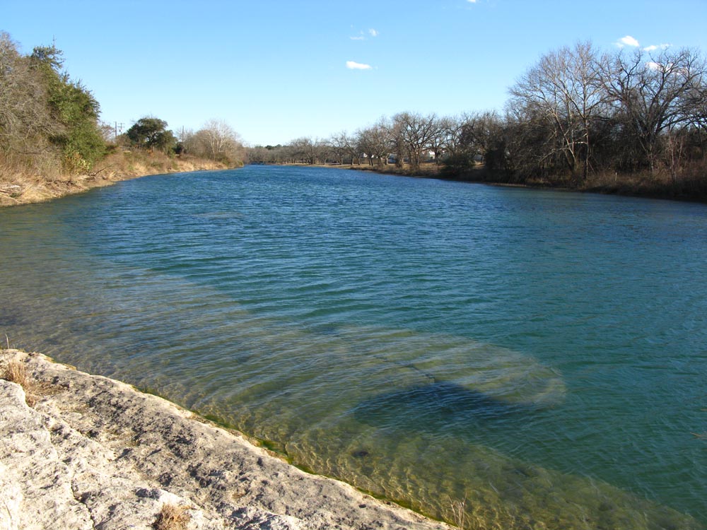
Blanco SP is on the southern edge of the town of Blanco. One mile of the spring fed Blanco river runs through the park. Smaller roads often have cattle guards (open range), so you have to dodge more then livestock. The numerous county roads in the area are good, but are frequently chip sealed, resulting in a rough ride. Limited traffic, and extremely hilly terrian make for fun and wickedely challenging rides. Be prepared with water, and stop when you can for refills. The water holes marked may not be open every day. The Real Ale Brewery is on the north side of town off of 281, near the Best Western.
| Name | Phone number | County Seat |
|---|---|---|
| Blanco SP | 830 833 4333 | |
| Blanco County Sheriff | 830 868 7104 | Johnson City |
| Kendall County Sheriff | 830 249 9721 | Boerne |
| Gillespie County Sheriff | 830 997 7585 | Fredericksburg |
| distance | Climbing | que Sheet | map | Garmin route | Google earth | Profile |
|---|---|---|---|---|---|---|
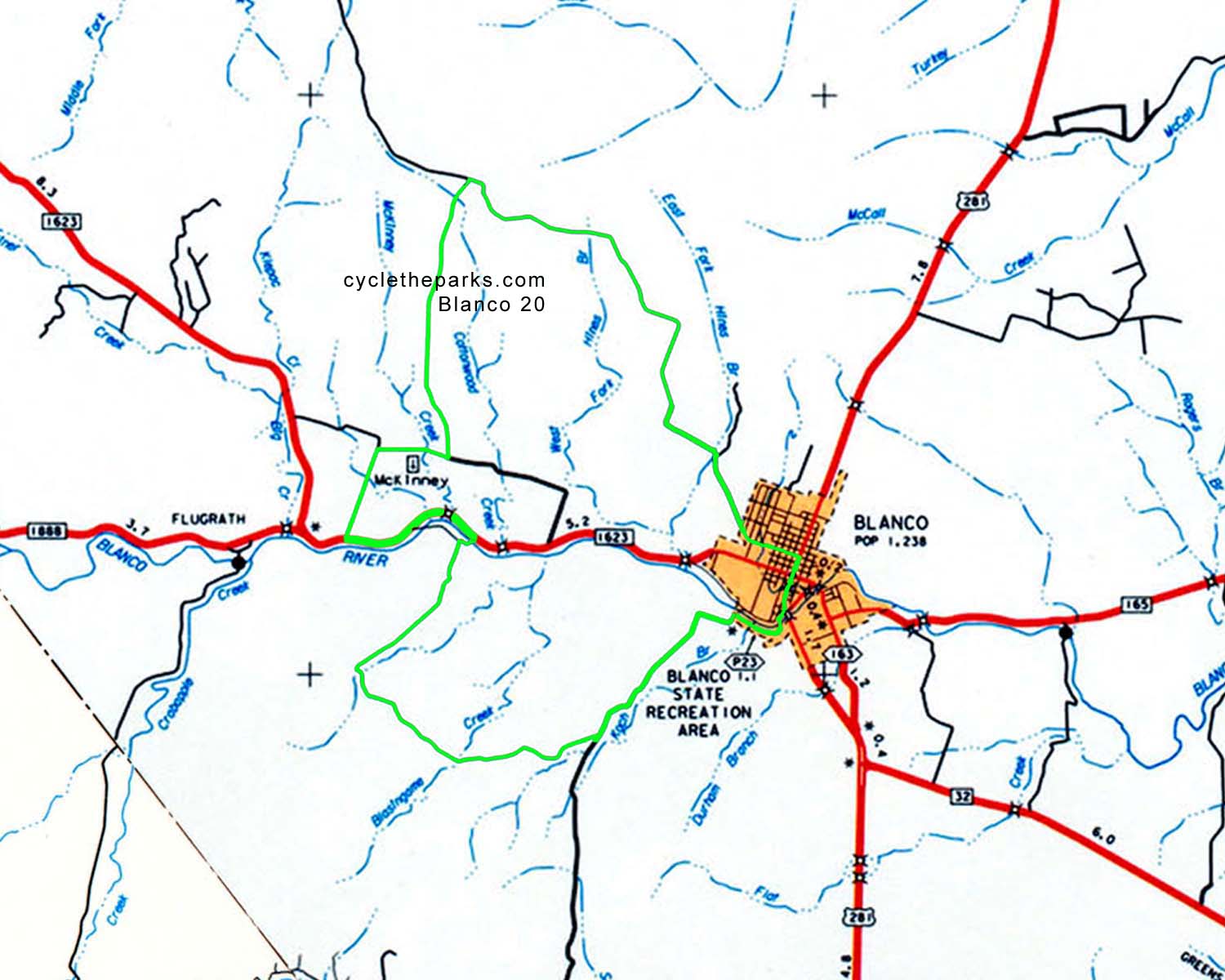
| 20 miles | 1468 feet | q-20 |
| route-20 | earth-20 |
|
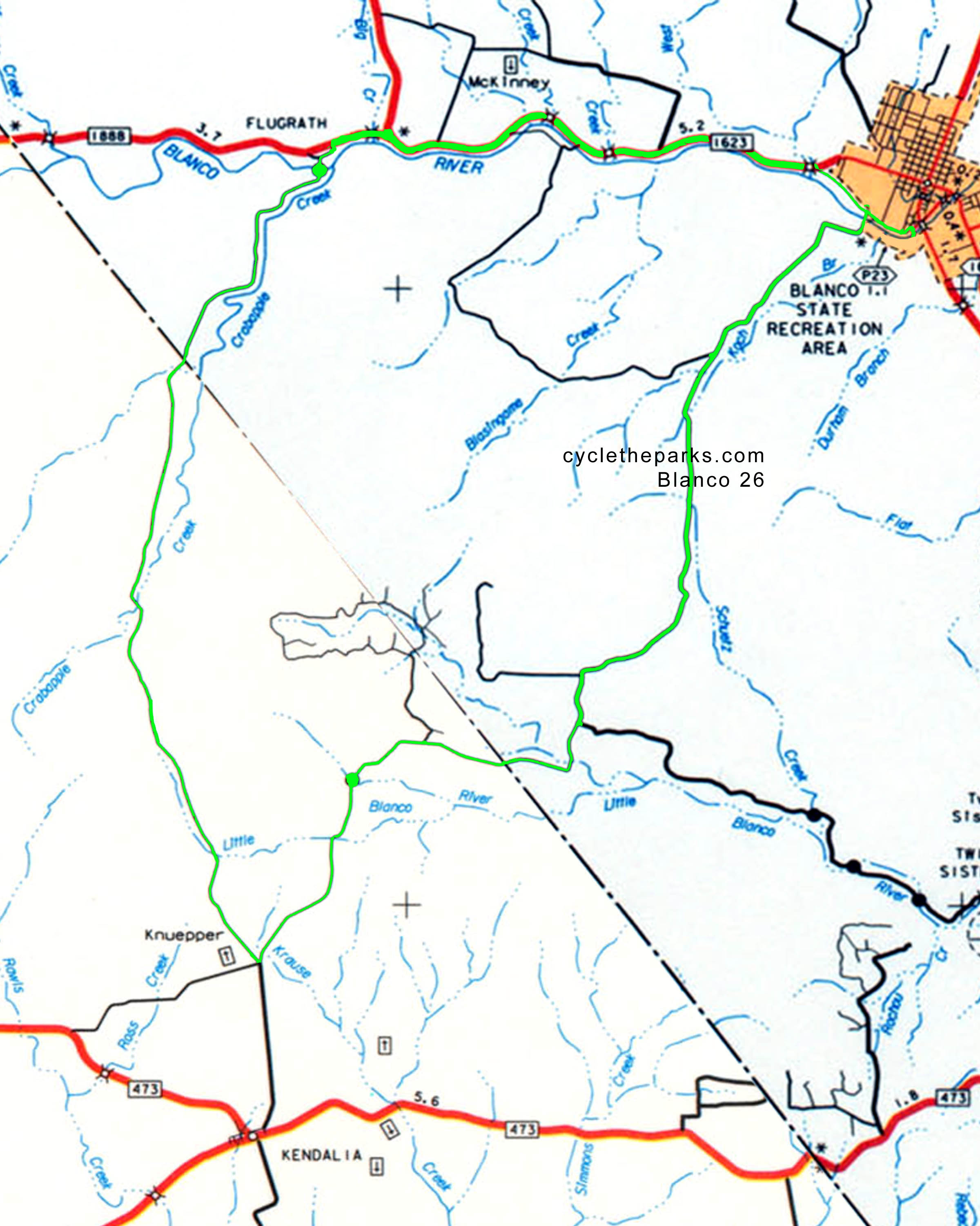
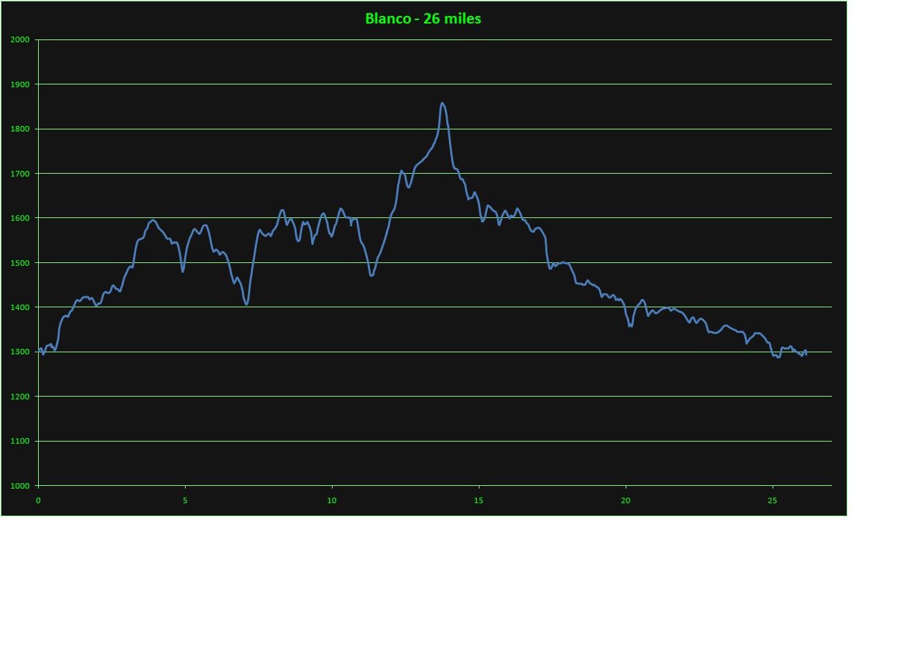
| 26 miles | 1406 feet | q-26 |
| route-26 | earth-26 |
|
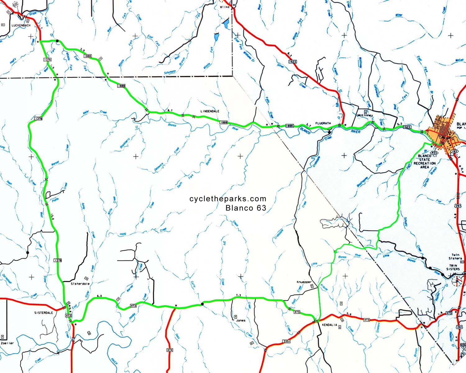
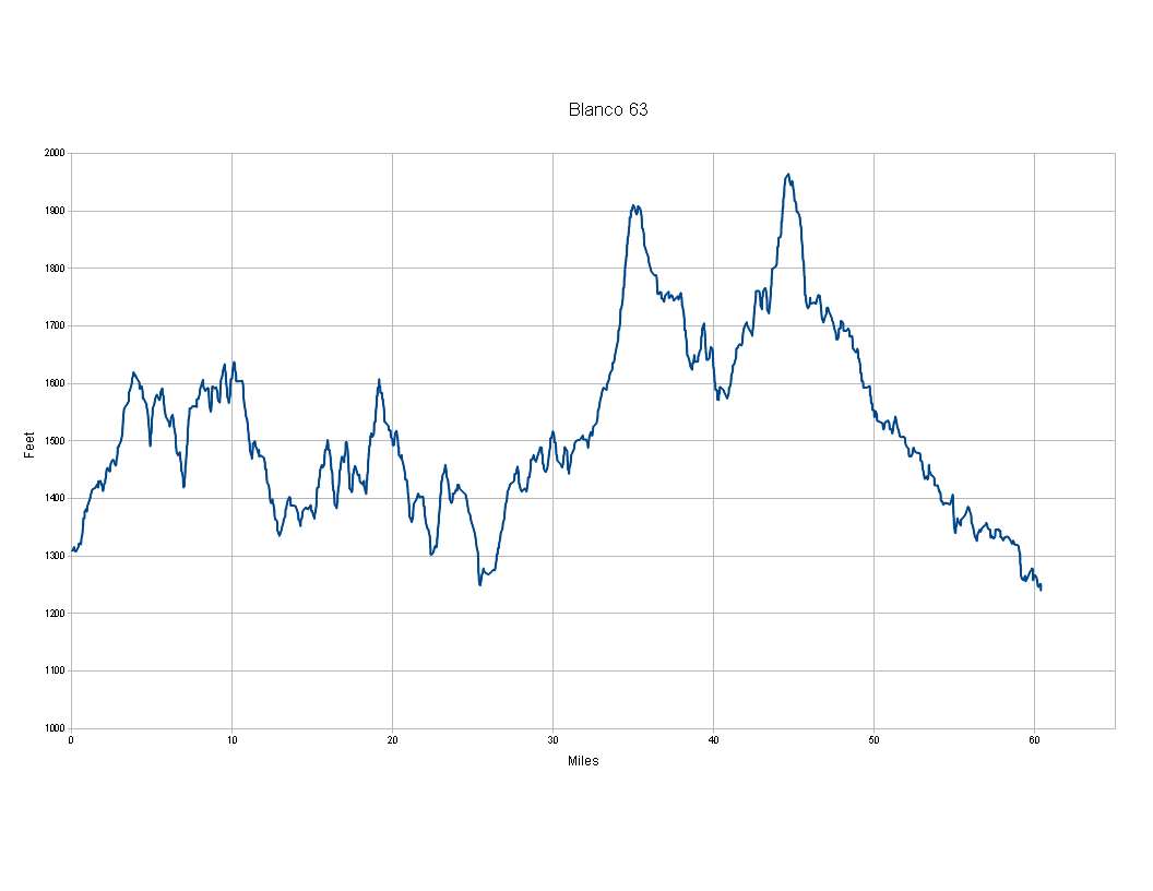
| 63 miles | 3918 feet | q-63 |
| route-63 | earth-63 |
|
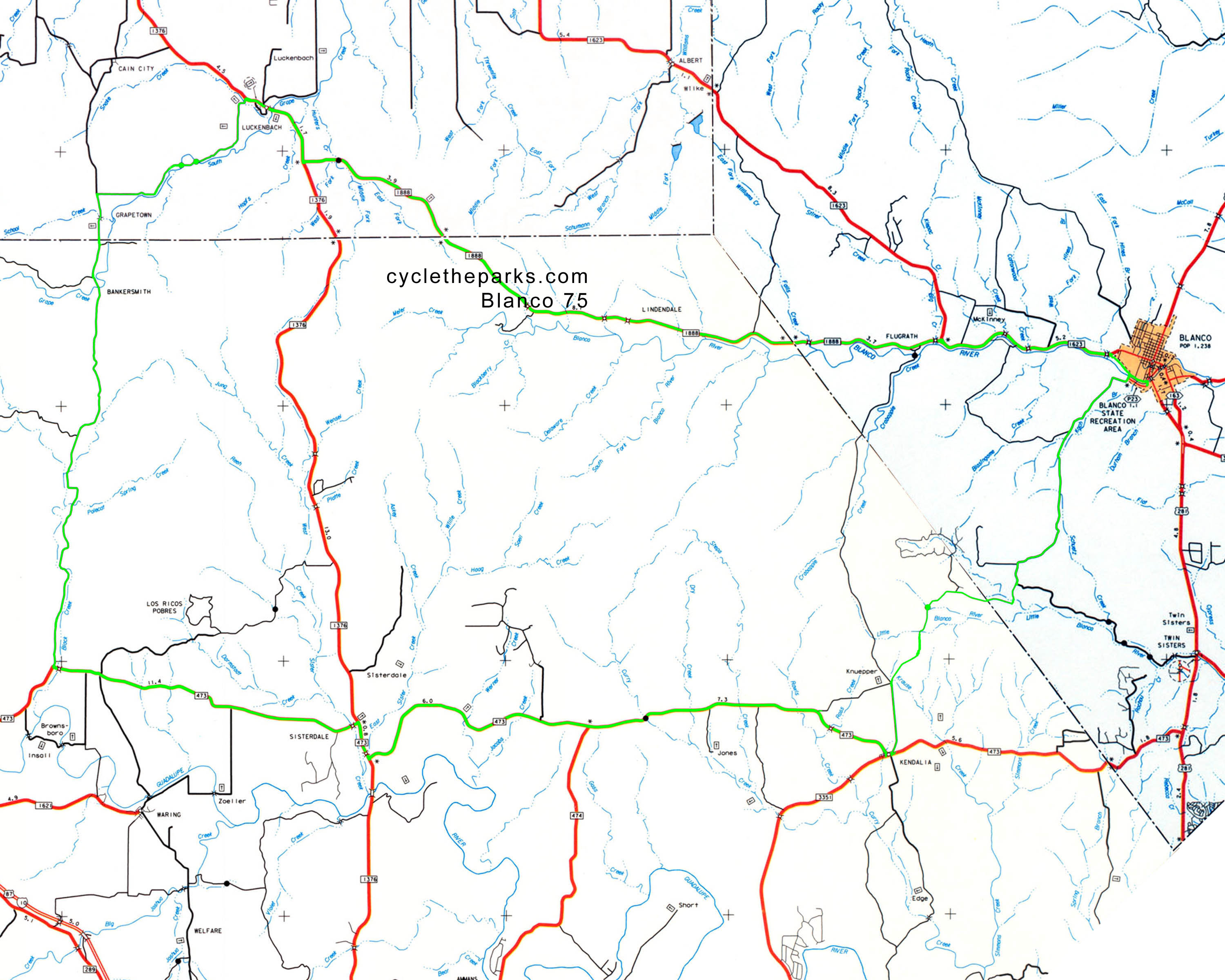
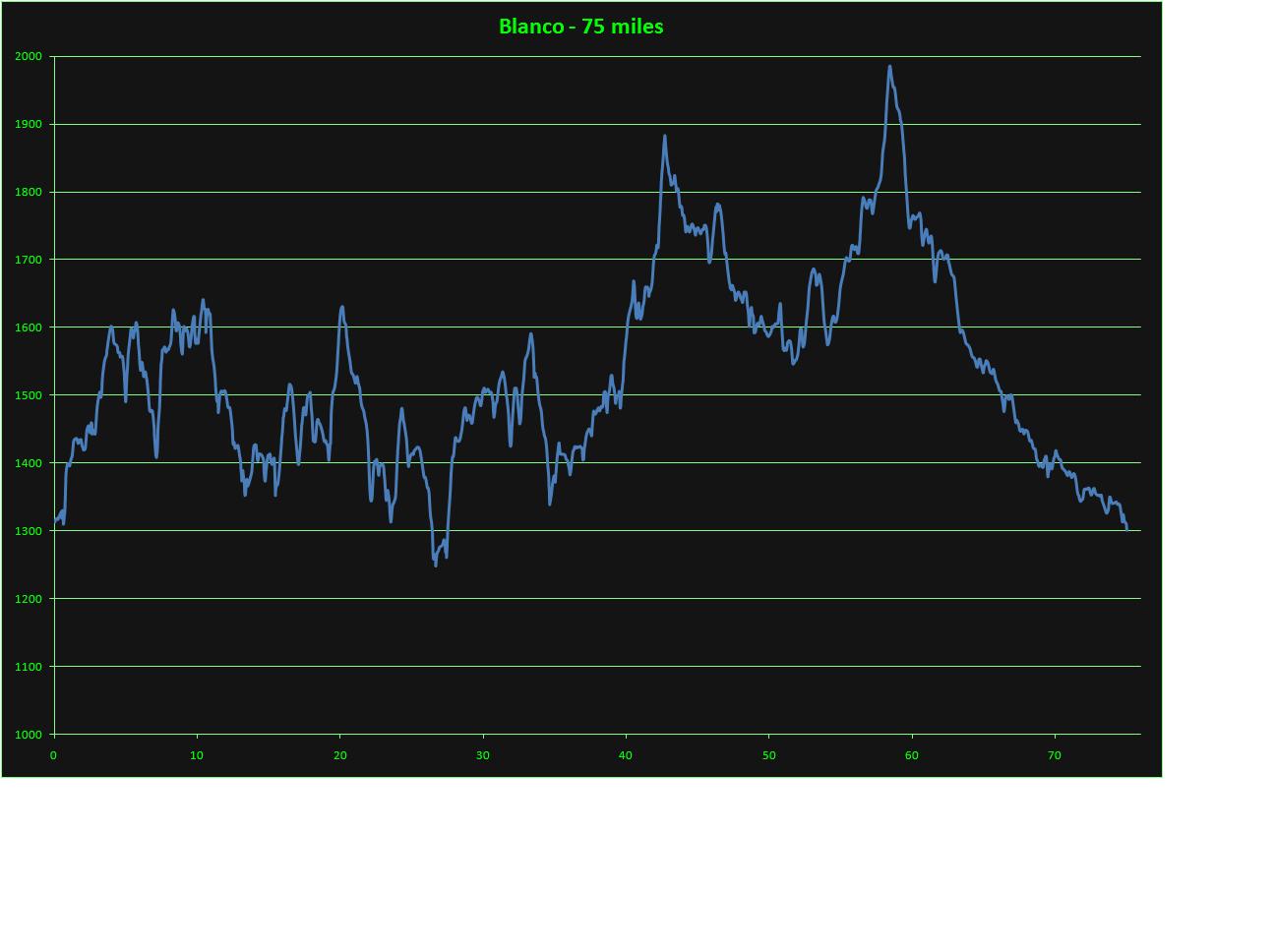
| 75 miles | 3756 feet | q-75 |
| route-75 | earth-75 |
|
For Google earth, right click and select "save as" or "save link as", remember your saved location. Then open Google Earth, , select File - open, navigate/select the newly saved file.
For Garmin routes, right click and select "save as" or "save link as", remember your saved location. Follow your Garmin's instructions on saving and using routes.